or, Rock 'N Ponderosa
on the Naneum Fan was not quiet at 2:30 a.m.
Report from Nancy and John Hultquist - for inclusion in
our weekly blog
Ellensburg, WA
<<< <<<<<<<<<< SET YOUR
MARGINS SO THAT THIS APPEARS AS A SINGLE LINE ACROSS THE
PAGE >>>>>>>> >>>
On Presidents' Day at 2:30 a.m. (PST), a truck fully loaded
with logs, was leaving from the Naneum Canyon heading south on
Naneum Road. Near our property line to the north is a
sweeping curve to the left (east). Our house sits back
over 350 feet from this curve. Our neighbor to the north
heard brakes and then what he described as an explosion.
He looked out his door and saw lights in the curve, and figured
someone had driven off the road. He called 911 to report
an accident, but did not go to the scene. A sheriff's
vehicle arrived about 3:30 a.m. We did not hear or see
anything until later, as we'll explain below.
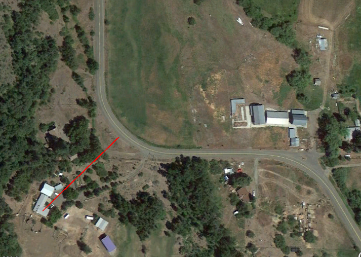
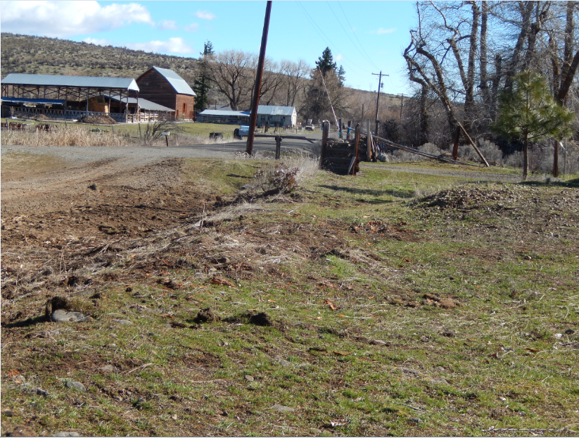
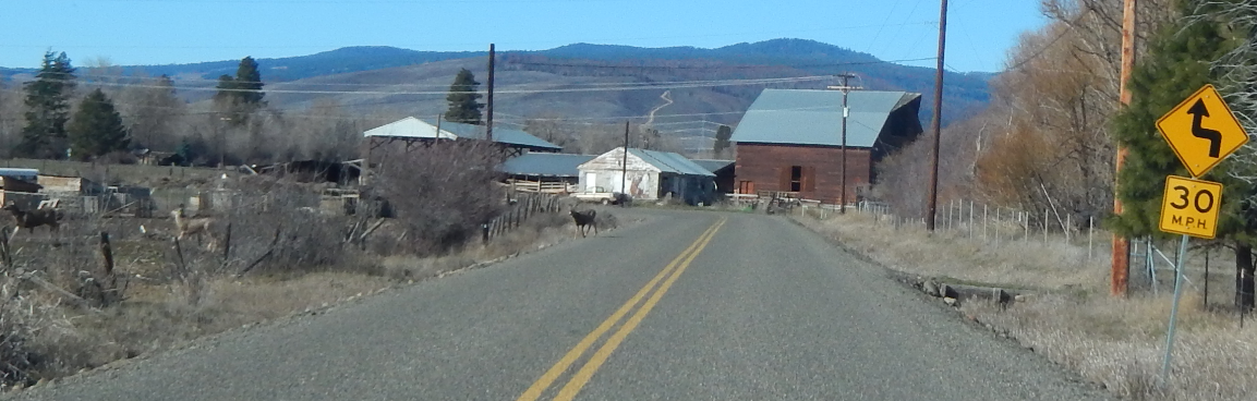
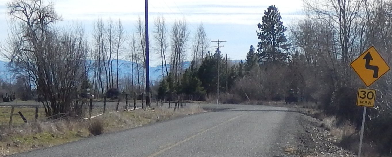
The left photo below is a locator map of the north-most location
of two curves for which people are supposed to slow down to 30
mph (Signs are posted but do not show on the street view of
Google Earth, from where the images below were derived).
One neighbor, a few driveways farther south, on the same side of
the road, has lost her front fence twice and had her mailbox
across the street "vaporized," by a speeding pick-up truck with
a canopy that flipped off into the ditch. That incident
was written up previously in our weekly blog. It happened
November 29, 2013. If you want access to the blog, just
ask.
Above, in the left photo, the red line starts at
the back of our house where we sleep and ends 369' at the corner
of Naneum Road, where the logging truck lost its load. The
right photo above is captured from Google Earth's street view, and
shows the road coming from the north, into the curve. Also,
note the electric-utility pole on the right.
This appears in a photo later with John holding out his arms to
demonstrate how close the logs came to "felling" the pole.
It is also visible in the final two photos taken after the logs
were removed.
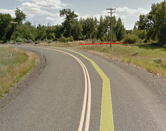
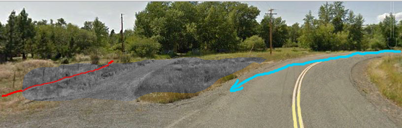
Above is another sketch from Google Earth's street view, made
by John for our blog, from the other direction at our front
entrance. As he described in the blog, this red line is our
north-fence and to the right of that -- our neighbor's
driveway. There is an open area and then Naneum Road.
North is to the right. The truck was coming from that direction as
shown by the blue line. The gray area was the spill
zone. Right of center is the electric-utility pole, which
was missed by about 8 feet.
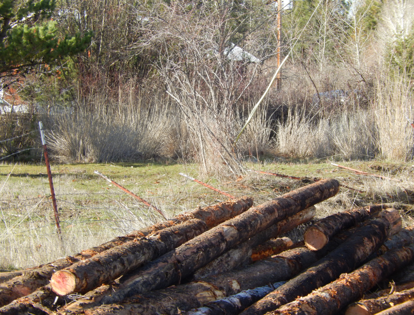
These
photos above show the logs that went up and over our fence
but had been moved back down by the time we took the
picture.
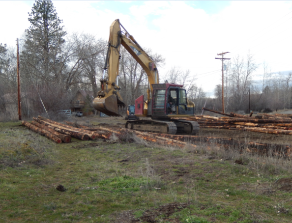
We learned the foresters are removing
trees destroyed by last summer's wildfire in the Naneum Canyon. They are using special
equipment for felling and trimming the trees (similar videos
are shown below). They need to
move them out late at night, when temperatures are lower and the
ground is harder with less mud. The destination for this
load of logs was Randle, WA at the mill there. When the accident
happened on Monday morning, several deer and a skunk were crossing
the road. The driver slowed, braked, and while
the deer got out of the way, the skunk did not. The driver
told the truck's owner (whom we visited with over the next two
days as he cleaned up the mess), that the right tire on the back
section of the truck went off the pavement. We think the
momentum coming around the curve added to the shifting of the
weight, breaking the chains supporting the load, and dumping it.
The truck stayed erect and was not hurt. This curve has been
the site of many accidents on both sides of the road for the last
25 years we have lived here. Most of the time, it's just a
car or truck running off the road, but other times there have been
other deposits, one being a load of gravel on the inside of the
curve. A county truck with a snowplow and a full load tipped
into the ditch. They hand-shoveled about 6 tons of gravel
from the truck before they could tip it back up and pull it out.
If you read our blog this week, Feb 22, 2015, titled Excitement
this Week, you've seen the links to You Tube videos of
the introduction, but to be sure, here are some of the
introductory videos, the first taken at 9:00 a.m. on our first
view of the day; the next two were taken at 11:00 a.m., Monday,
February 16, 2015. Watch for skid marks and look at
the edge of the road for rocks and holes.
Above is an early morning view of the scene, before too much was
moved (see also the videos above for the entire scene).
One can still see the logs on the edge of the road. Some of
the others in front of the Case "skidder" were moved in
the dark to allow driveway access to the neighbor's house.
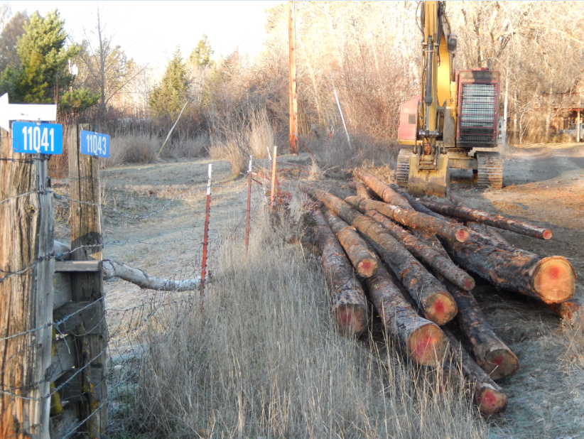
The left photo above
was taken just before 9:00 a.m. at the front entrance of the
driveway to our house and property. The far right of that
photo is the driveway to our neighbor's house. The logs
had been removed from our hill behind the crushed fence.
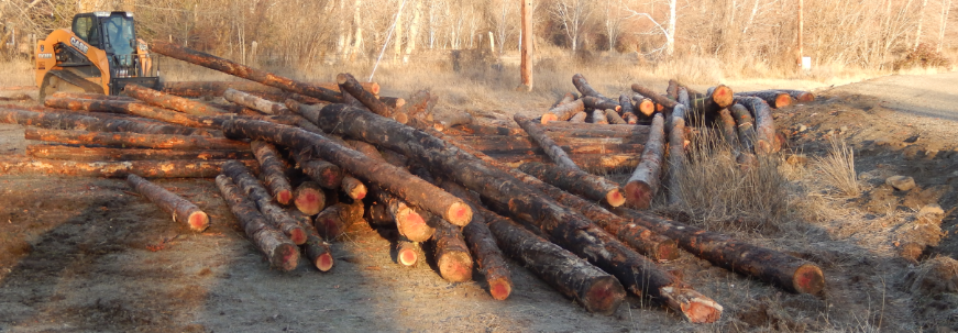
During the rest of the day, on Monday, the logs were moved into
a position such that they could be reloaded on the original
truck Tuesday morning for the rest of their journey. In
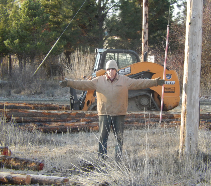
the right photo above, John stretches his hands (about a 6'
reach) to show the distance from the fallen logs to the
electric-utility pole. The logs behind John were moved
from blocking the driveway access to our neighbor's house.
Note the ends of the logs have a red-painted spot. That
indicates the trees were harvested from the Department of
Natural Resources (DNR) land (using a timber sale). We
know that DNR sells timber from their trust lands that provides
money to fund state schools, universities, mental hospitals, and
other agencies that provide county services. Note, the red dots are not
spray painted on until after the logs are loaded on the
truck. Otherwise, the scuffling that occurs while lifting,
skidding, and loading, might remove the marks.
The logs are
Ponderosa pine (Pinus ponderosa), also called Western
yellow pine, blackjack pine, or bull pine.
The next section below involves the disassembling of the
broken-down fence, all the way to the rock crib at our entrance,
because that part will have to be repaired first, with a wooden
dowel rail fence. We are not replacing the horrible mess
that was there. Originally, the posts had four strands of
barbed wire. Then, to keep sheep in, they added "hog wire"
to the lower 3 feet. A link that shows the spacing of the
wires (close at the bottom, bigger spaces at the top)
follows: http://www.unionagway.com/Fencing/696061%20hog%20panel.jpg
The rolling logs made a mess of poles and wires--with at least 40
feet being completely demolished. We are viewing this as a
positive event giving us the opportunity to completely redesign
the front gate entrance pull-off, driveway, fence, and yard near
the entrance. The changed access and the "view from the
road" will be much improved. John is currently outside
dismantling the old rock crib seen in several videos and photos in
this report. Currently, ours and our neighbor's address
signs are attached to two posts on this landmark. Such rock
cribs have been used throughout the West as fence corner markers
or intervening supports and are a means of using some of the
hundreds of rocks on the landscape. Stay tuned for the
developing new story.
While we're replacing the fence, we will re-contour the
land, clean off the rock piles, fill the holes, and have our legal
property boundaries surveyed. These have been unknown too
long, as parts of these plots were previously part of a much
larger land holding. The last thing we want to do is put a
new fence on a county road's Right of Way (R-O-W), or onto our
neighbor's land. As well, we need the boundaries on the
eastern edge of our property to repair old fencing that doesn't
appear properly situated -- but instead, lines up with old
irrigation ditches around and through the property.
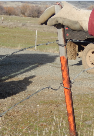
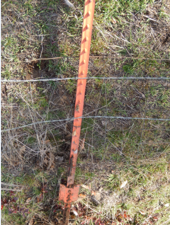
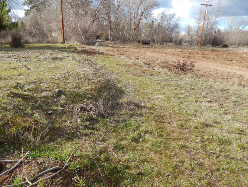
These
photos above show the fence makeup. Barbed wire
was clipped to steel posts. The middle one shows a
relatively straight fence post, resting on the
ground. Most posts were bent beyond use, as seen
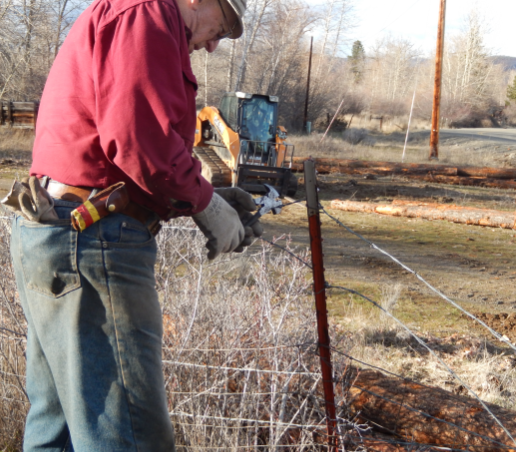
below. Before removal by the backhoe's claw, John
removed the fencing from the last standing post.
Below is a short video (35 seconds) of that event.
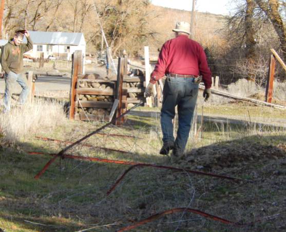
Above, John walks toward the rock cribs on either side of our
driveway entrance after the fence posts have been "clawed" out by
the backhoe, already deformed by the rolling logs. Links to
that procedure follow.
Watch the activity below. I find it interesting to see
how the operator can use the claw as if it is an extension
of his hand, as in brushing the vegetation out of the
way. Note the gravel truck
(from Charlton Road gravel pit, 2.25 miles away), driving
rapidly around our corner. Maybe in the future we will
get a free load of gravel!
Below is a fast 33
seconds of John, moving fence out on the far end, picking up a
loose fence post from end and tossing it, then moving the
dug-out Sarvis berry tree out of the way. Notice the old
fence on the ground, which he eventually moves so that logs can
be put on that higher land for storing overnight.
The next video demonstrates why the operator determined that
moving the logs onto our property once the fence was gone,
worked better with using the big claw (33" wide) on the large
backhoe, instead of the skidder's lifter. Note the sound
made when it's backing up. That intermittent sound for a
half hour or more is what awakened me at 5:15 a.m., Monday
morning.
The
switch was made to the backhoe claw usage for the rest
of the moving logs to the place on our land to await
pick up in the morning and re-loading onto the
original truck that lost them.
Below are some links to
that process. First shows the beginning, with John still
pulling the felled fence out of the way.
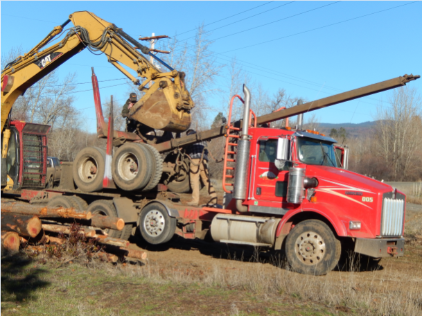
The red truck above is the original truck that lost its load
on Monday, drove off to Ellensburg to be checked out, and came
back on Tuesday morning to be reloaded for the continuation of the
log delivery to Randle, WA. The backhoe is used to lift the
back wheels to create the trailer for the logs. I'm sorry I
had to leave for a doctor's visit in Yakima and could not finish
the documentation of this event, completely to the
reloading. You'll just have to imagine the loading process,
after seeing all the equipment moving the logs around the scene.
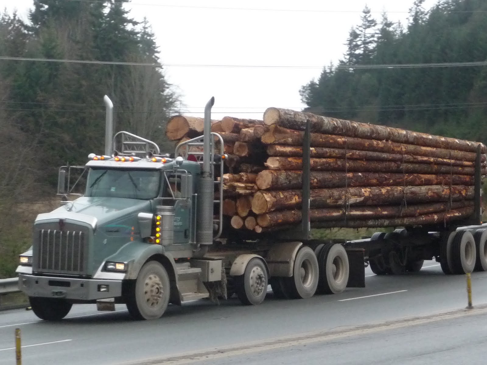
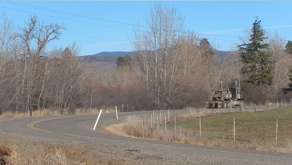
The left photo above I obtained on the web showing a fully loaded
logging truck, near Port Angeles & Sequim, WA. The right
photo I took of an empty logging truck heading north Monday on our
curve.
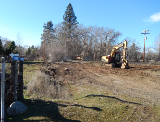
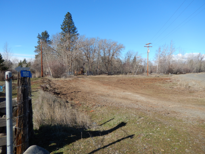
The
view at 3:00 p.m, Tuesday afternoon, when we returned from
Yakima to find all the logs gone. The next day, the
backhoe was gone.
You'll
just have to merge the two photos above, because I don't
have any easy way of combining them into a landscape
view. Note the electric-utility pole (John was
standing next to above) is in both photos. Look to the
right of that in both pictures and farther in the picture on
the right to get the whole curve and road in it.
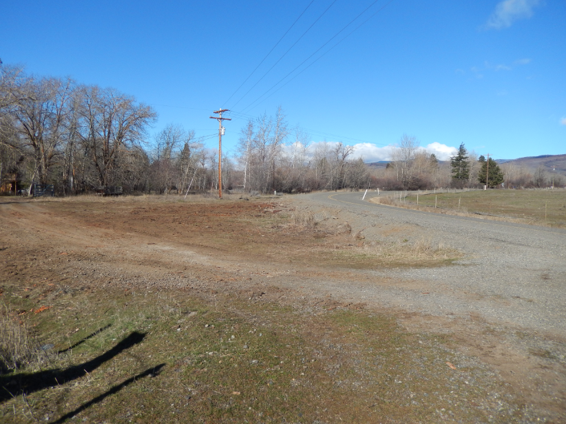
You may view what it now looks like all cleaned up, in the
video below, from right to left plus including more of our
property showing what will be re-contoured.
Now we have to regroup, re-contour our land, and build a new
fence, but first, we must hire a land surveyor to determine
our correct property lines.
Re-contouring will start next week by a landscaper, with his
backhoe and bulldozer. He has done earth moving for us
before (in 2012). He is going to get rid of the rock
piles and holes, grade it to make it easier to fence, grow
grass, and mow. He's already reviewed the
situation this past weekend.
The owner of the
logging truck will return with an auger and help us seat the
posts, when we get the land ready to fence.
Fortunately, our horses do not need to be fenced from that part of
our property until summer. They can access the other side of
the driveway, all the way to the road. That fence was not
leveled, but will need to be replaced to match the other part of
the new fence out front. We also can close them out of that
area, while we are replacing that part of the front fence.
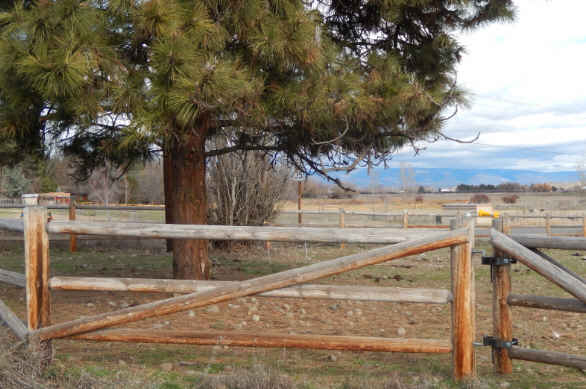
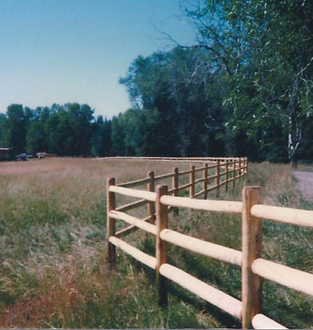
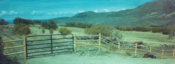
Before we sign off, in case anyone is interested in the timber
harvesting process (I was), check out this information
below. In addition, we have spoken to several folks about
the need for taking the trees out after a wildfire, versus leaving
them. The consensus is that it is better to replant than to
allow brush to grow up around the old burned growth. There's
always the problem of erosion after a fire, possibly enhanced by
heavy equipment in the area, but especially during rain events, or
even melting snow.
The logs were destined for Randle, WA for the mill there.
Here are some comments about the harvest and the mill details that
John assembled for me to share.
This first below is located in Ellensburg, installed by a local
fencing business. Others are from the web.
Perhaps these photos portray similar
landscape results of our planned future story's finale ?
Today, Tuesday, February 24, 2015, on my way to and from
town, I took some pictures of the road signs that were
installed within the last couple of years, after the other
accidents on this northern section of Naneum Road.
Note this first below has three deer. Can you see
them? I was driving home at 2:51 p.m. (PST) with my
neighbor, and we saw all three on the road. By the
time I stopped and got my camera, they had moved, but I
snapped this anyway. A good ending to the story,
because several deer and a skunk, crossing the road, were
what caused this whole chain of events.
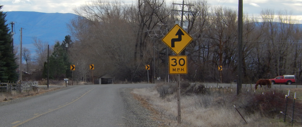
Finally, to get this picture above, I drove through our
curve and north, parked my car, and walked for this view. The road has
five such wicked curve segments within a several-mile
distance, including straight sections of road with a
50mph speed limit. The
whole section of the curve receiving the logs shows from the
rock crib at our entrance (far left of photo). You can
see the proximity of the 30mph sign warning of the curve
ahead, but we need to have an additional line of large
left-pointing arrows on the curve. Actually the
southern-most 2 curves on Naneum Road do have those on both
ends. My neighbor to the south, mentioned above, is
going to submit another request to the Public Works
Department about installing better signage on our
curves. She plans to give them a link to this
story. Stay tuned.
Thursday, February 26, I took a photo of the large arrow
signs behind the warning one, on the lower section of
the Naneum Road curve, heading from the north. Both
entrances to that curve have the larger signs. We
believe such large arrows should be added to all the curves
to the north, between Thomas and Charlton Roads.
This page was produced by Nancy
Hultquist to link to
our blog, which is posted weekly. This was queued in
the 3rd week of February's edition. A big thank you to
my friend Elise Schlosser in New Jersey for helping proof
this treatise to make it more understandable to a person who
has never set foot on our property or driven through the
Naneum Road curves.